ARCHI Archaeological Sites: Old Maps
Scroll down below to find old maps of England, older English county maps from 1724, old maps of Ireland from 1609 or view a representation of Anglo-Saxon London.
-Sussex_low_res_500x.jpg)
Rare English County Old Maps
A set of 52, lovely high resolution English County old antique maps by the German-born London cartographer, engraver, and publisher Herman Moll. This set of maps dating from 1724.
View Maps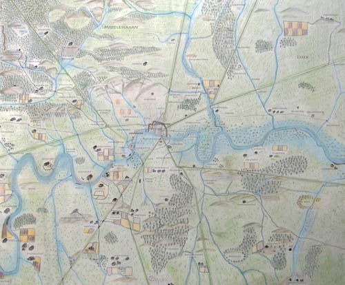
Anglo-Saxon Map of London
A high resolution map created by The Londonist showing the London area in Anglo Saxon times (roughly speaking, 500-1066AD). Showing the many villages, hamlets and farmsteads whose names are still part of modern London today. The map also shows the major ROMAN roads in London.
View Maps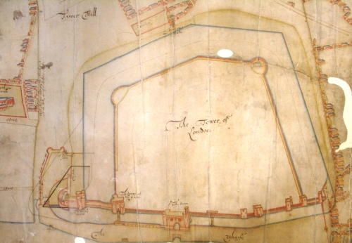
Early 17th Century Plan of the Tower of London / Old Map of the Tower of London, England
Tower of London: General. Plan shows the Tower and its gates and bulwark; wharf, rivergate [Traitor's Gate] and stairs; streets, houses and Barking church to the west; Tower Hill, 'Crochet Friars' [Crutched Friars]. and East Smithfield to the north; St Katherine's to the east. Scale bar: 1 inch to about 70 feet. Damaged at edges.Annotated: 'A coppy of Mr Hewards Mapp verified by Jonas Moore'. This refers to William Hayward and Joel Gascoyne's map of 1597, known from later engraving. Sir Jonas Moore was Surveyor of the Ordnance and resident at the Tower in the 1670s; he signed and verified this copy map. English National Archives' Reference Number: WORK 31/21
View Plan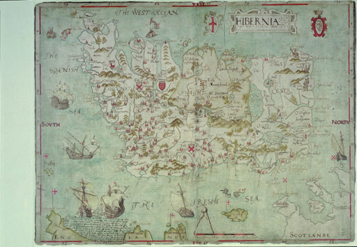
Rare Old Maps of Ireland
Lovely high resolution old maps dating from 1609 showing various old Irish lands.
View Images
Old Ordnance Survey Maps of England and Scotland
If you want to find an old map of a place in Britain, just type in British postcode, placename or co-ordinate below and look for the link to the old map at the top of the list generated from the ARCHI database.
A password is only needed for additional information such as the location of archaeological and historic sites in the area. Otherwise, leave the password box blank.