ARCHI Old Photograph Gallery
Old Photographs of Archaeological, Ancient and Historic Sites
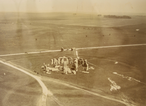
Stonehenge from a hot air balloon - 1906!: The earliest aerial photographs of stonehenge and other british and worldwide archaeological sites in glorious high-resolution.
View Images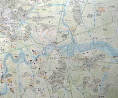
Saxon Map of London
A high resolution map created by The Londonist showing the London area in Anglo Saxon times (roughly speaking, 500-1066AD). Showing the many villages, hamlets and farmsteads whose names are still part of modern London today. The map also shows the major ROMAN roads in London.
View Images-Sussex_500x.jpg)
English County Old Maps
A set of 52, lovely high resolution English County old maps dating from 1724.
View Images© Digital Documents 2015